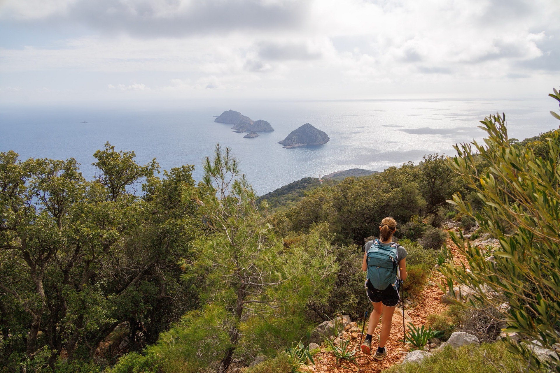
A week is the time most of you have. It is also the trip length behind the question we hear most: where should we start? Our answer draws on the real stages of our programmes and the figures they give. For a stage-by-stage planning method, see our guide How to choose a Lycian Way section and plan reliable stages, and for a map of the whole route, Lycian Way map and sections.
Can you walk the Lycian Way in seven days?
Not all of it. The Culture Routes Society, which maintains the trail, now gives 760 km and about 35 days of walking between Ovacık, above Ölüdeniz, and the hills of Geyikbayırı west of Antalya. The 509 or 540 km figures you still see refer to the older line, before extensions and variants.
Seven days on the ground, including arrival and departure, leave five or six walking days in practice. That is enough to cover one coherent section, sleep in its villages and understand how the trail keeps switching between the sea and the mountains. In the west, that is enough to walk from Ölüdeniz to Gey and keep a day for Patara.
So the real question is not "how many kilometres" but "what kind of week". The Lycian coast does not offer one standard week. It offers at least three, and they are very different.
To place these areas, the official site of the Turkish Ministry of Culture and Tourism divides the trail into 31 numbered map sheets, from Ovacık–Kirme (sheet 1) to Sarıçınar–Hisarçandır (sheet 31). The western week covers roughly sheets 1 to 7, as far as Patara; the Tahtalı forests and Göynük take up the last ones. The main route is waymarked in red and white. Marks fade where new roads have been cut, as the Ministry itself points out, so an up-to-date GPS track is useful even on the busiest sections.
Three Lycian weeks, three characters
The table compares the three ways of spending a week on the Lycian Way that we organise. The figures come from the programmes listed; they describe our stages, not an official guidebook.
| Week | Area | Format | Benchmark day | Boat | Best for |
|---|---|---|---|---|---|
| Self-guided Lycian Way (7 days, level 3/5) | Fethiye, Ölüdeniz, Faralya, Kabak, Alınca, Gey, Patara | Self-guided: route book, GPS tracks, luggage transfers | The climb from Kabak to Alınca | No | Independent walkers who like coves and ridge villages |
| Chimaera, Kekova & Termessos (8 days, level 3/5) | Çıralı, Maden, Andriake, Simena, Aperlai, Faralya, Ölüdeniz, Termessos | Guided, group of 4 to 15 | Andriake–Simena: 14.7 km, +200 m, graded difficult | Yes, from Maden back to Çıralı | Walkers who want both ends of Lycia in a week |
| Antalya to Kekova (13 days, level 3/5) | Göynük, Yaylakuzdere, Beycik, Maden, Çıralı, Olympos, Adrasan | Guided | Göynük–Yaylakuzdere: +1,110 m, 5–6 h | Yes, at the end (Kekova) | Strong walkers who prefer forest and passes to beaches |
The third row is a thirteen-day trip. We include it because its first week, from Antalya to Adrasan, is on its own the best example of a "mountain week" on the Lycian Way.
The west: Ölüdeniz, Faralya, Kabak, Alınca, Gey
This is the official start of the trail and, for many, its most photographed section. Our self-guided Lycian Way follows it in order: arrival in Fethiye, then Ölüdeniz–Faralya, Faralya–Kabak, Kabak–Alınca and Alınca–Gey, followed by a day at Patara.
The first two days follow the cliffs. The path looks down on the Ölüdeniz lagoon, passes above Butterfly Valley and drops to Faralya. The next day leads to Kabak and its cove, where you swim after walking. It is beautiful, but it is not flat: descents on loose stone tire you more than you expect.
Day four changes everything. From Kabak the path climbs to Alınca, high above the sea. This is the day that tells you whether the week suits you. After that you walk from village to village along the ridges to Gey, away from the coast, among terraces, oaks and hamlets. The Patara day brings together the long beach and the ancient city.
This week is walked without a guide. Guesthouses are booked stage by stage, the route book and GPS tracks are provided and your luggage moves every day. In return, you find the way yourself and handle anything unexpected. Site entrance fees are not included in this format, nor is the airport transfer on the last day.
Kekova and the Chimaera: trail, boat and ancient cities
If you want to see the Lycia of ruins and bays in one week, the Chimaera, Kekova & Termessos trip is built for it. It is not a continuous traverse: it is a selection of walks linked by transfer.
The programme starts at Çıralı. Day two combines the Chimaera flames (Yanartaş), gas that has burned out of the rock since antiquity, with the descent to Maden bay: 11.1 km, +350 m, −570 m, and a boat back. Day three, from Andriake to Simena, is the longest walk of the week at 14.7 km. The climbing is modest, but the limestone and the exposure to the sun justify its "difficult" grade.
Next come Kılınçlı–Aperlai, a remote city at the water’s edge, two stages to Faralya from Alınca and from Kirme, and the descent from Kozağaç to the Ölüdeniz lagoon (−480 m). A visit to Termessos, in the mountains above Antalya, ends the trip. Watch the profile: the Alınca and Kirme stages descend 720 m and 700 m.
At Kekova, the boat runs along the sunken ruins of the old town. Swimming over the protected remains is not allowed; you swim in the neighbouring coves.
The Tahtalı forests: the most mountainous week
In the east, between Antalya and Adrasan, the Lycian Way leaves the coves for the pines, cedars and junipers of the Beydağları range, facing Mount Tahtalı (2,365 m), the Lycian Olympus. This is the section we suggest to walkers who already know the mountains.
Our Lycian Way from Antalya to Kekova shows what it involves in its first week. Day 2: Gedeller, the ruins of Onobara and Sarısu beach, +300 m. Day 3: from the fishing harbour to Göynük via Beldibi, +450 m. Day 4: up the Göynük canyon to the hamlet of the same name, +1,110 m in 5 to 6 hours. Day 5: from Yaylakuzdere to the pass below Tahtalı, then down to Beycik, +925 m and −980 m.
Then the route drops back to the sea: Ulupınar–Maden–Çıralı (−760 m), the Chimaera in the evening, and the crossing of Mount Musa from Olympos to Adrasan, +730 m in 6 to 7 hours. The contrast with the west is clear: here, two days climb more than 900 m.
For a single week, this area can be arranged to measure; tell us your dates and your level.
Dalaman or Antalya: the airport often decides
People underestimate this. The Lycian Way stretches between two airports, and a one-week trip cannot absorb a long day on the road.
- Via Dalaman, you are close to Fethiye and Ölüdeniz: the Culture Routes Society puts the trailhead about two hours from the airport. This is the gateway to the west.
- Via Antalya, you are at the foot of the Beydağları: Göynük, Çıralı and Olympos are a transfer away, and the city itself deserves an evening in Kaleiçi.
- Kaş and Kalkan, in the middle, are two to three hours from each airport: good bases for a week of day walks, less so for a point-to-point week where every half-day counts.
If your flights land in Antalya, do not choose the west on principle: you would lose half a day at each end.
How many kilometres and how much climbing per day?
On our Lycian stages, a typical day means 4 to 6 hours of actual walking, not counting breaks. Published distances range from about 5 to 15 km. On this trail it is not the distance that tires you, it is the ground: sharp limestone, rolling stones, uneven steps, and climbs that repeat day after day.
To judge a week, look for three figures in the programme:
- the biggest climb of the week (here from +350 m on the coast to +1,110 m in the Beydağları);
- the biggest descent, often underestimated (up to −980 m);
- how many demanding days come in a row.
A regular walker used to five hours with a light pack will be comfortable on a level 3/5 week in the west or around Kekova. For the Tahtalı forests, you should have strung mountain days together before. And everywhere, heat changes everything: in July and August, average highs reach 34.9 °C in Antalya (MGM normals 1991–2020). Our Lycian weeks run from April to June and from September to October; month by month, see Lycian Way by month.
In autumn there is one more point. In 2026 the Antalya governorship restricts entry to forests until 31 October, with listed exceptions that include the Geyikbayırı–Çıralı stretch of the Lycian Way. Muğla, to the west, has its own rules. We plan our routes around them; if you walk on your own, check them for your stretch.
Guided or self-guided for one week?
Over seven days, the format matters as much as the section.
Self-guided, you keep your own pace and breaks. You leave when you like and stop at the cove you like. The other side: navigation, deciding on a shortcut when the heat builds, dealing with a twisted ankle are all up to you. The west suits this well, because villages are close together and stages are easy to read.
Guided, a Turkish hiking guide who speaks your group’s language handles transfers, boats, timings and fallback options. Entrance fees for the sites in the programme are included, as is full board except on the first and last days. For areas linked by road, such as Kekova and the Chimaera, it is the simplest solution.
Our guide to guided or self-guided travel in Türkiye compares the two.
What if you also want to see Cappadocia?
We are asked this often. One week is not enough for both regions without spending days in a car. The Cappadocia & the Lycian Coast trip gives them thirteen days: the valleys first, then four Lycian days between Ulupınar, Maden bay, Çıralı, Aperlai and Kekova.
If you only have seven days, choose one region and walk it properly. To compare destinations, read which trek to choose in Türkiye; for seasons, when to go hiking in Türkiye. Practical questions (insurance, visas, level) are answered on our FAQ page, and the whole region is on the Lycian Coast page.
Distances, climbs and times: the Aventures Anatoliennes programmes listed. Trail length: Culture Routes Society. Climate: MGM normals 1991–2020.