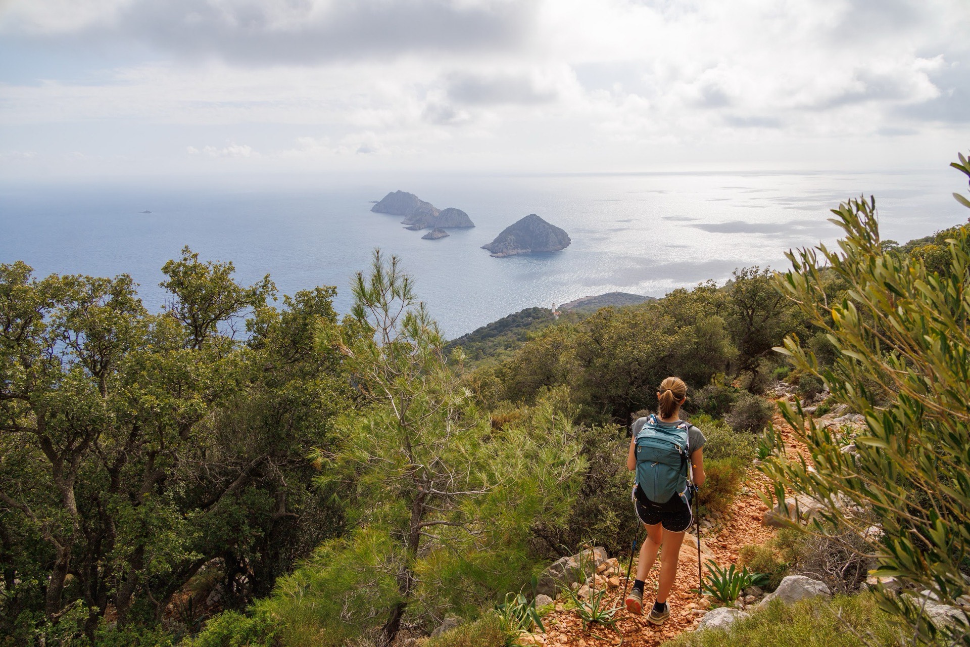
We get this question with almost every enquiry, and our answer always starts with another question: where do you want to walk? Turkey is a thousand kilometres wide, with a hot Mediterranean coast, a high continental plateau and mountains that rise above 5,000 m in the east. The same month can be perfect around Kaş and too cold in Göreme, or ideal in Cappadocia and far too early for Ararat. Here is how we think it through, region by region, using the seasons we publish for our own trips and the records of the Turkish State Meteorological Service.
What is the best time of year to hike in Turkey?
On the coast (Lycia, Caria), aim for spring and autumn: April to June, then September to October. In Cappadocia you can walk all year, with spring and autumn the most comfortable. For the gorges of the Aladağlar in the Taurus, our window runs from May to October. For Ararat it narrows to July–September.
These are the periods printed on our trip pages, and each one answers a specific constraint: heat pressing down on the coast in high summer, snow lying on the Cappadocian plateau in some winters, old snow closing the upper Taurus in spring, and the short high-altitude season on Ararat.
| Month | Lycia | Caria (Latmos) | Cappadocia | Aladağlar | Ararat |
|---|---|---|---|---|---|
| January – February | Outside our season: rain, short days | Outside our season | Possible: cold, snow on some days | Outside our season | No |
| March | Outside our season, transition | Outside our season | Possible, trails sometimes muddy | Outside our season | No |
| April | Good | Good | Good | Outside our season | No |
| May | Good | Good | Good | Good, snow patches possible up high | No |
| June | Good, heat building | Outside our season: hot | Good | Good | No |
| July – August | Outside our season: very hot | Outside our season: very hot | Possible, with early starts | Good | Good |
| September | Good, still hot at first | Good | Good | Good | Good |
| October | Good | Good | Good | Good, cool nights | No |
| November | Possible: Antalya–Kekova and the Cappadocia–Lycia combination | Outside our season | Possible, short days | Outside our season | No |
| December | Outside our season | Outside our season | Possible: cold, snow on some days | Outside our season | No |
"Good" refers to the periods published on our trip pages: Lycian Way, self-guided and Chimaera, Kekova and Termessos (April–June, September–October), Cappadocia and the Lycian Coast (April–June, September–November), The Lycian Way from Antalya to Kekova (April–June, September–November), Trails of Cappadocia and Cappadocia–Istanbul (all year), Cappadocia, Call of the Hidden Valleys (March to mid-November), Cappadocia and Taurus (May–October), the Carian Trail, Latmos and cruise (April–May, September–October) and Artos–Ararat (July–September). "Possible" means you can walk, but you accept clear constraints.
What do the Turkish weather service records show?
The Turkish State Meteorological Service (MGM) publishes monthly climate normals for every province, calculated over 1991–2020. We picked three stations that frame our walking regions: Antalya for the Lycian coast, Nevşehir for Cappadocia, and Van for the east, on the way to Ararat.
| Month | Antalya max / min | Nevşehir max / min | Van max / min |
|---|---|---|---|
| January | 15.0 / 5.9 °C | 4.1 / −3.5 °C | 2.9 / −6.0 °C |
| April | 21.8 / 11.3 °C | 16.3 / 5.2 °C | 13.2 / 3.6 °C |
| May | 26.4 / 15.7 °C | 21.2 / 9.3 °C | 18.6 / 8.0 °C |
| July | 34.9 / 23.4 °C | 29.3 / 14.6 °C | 28.3 / 16.0 °C |
| September | 31.7 / 20.1 °C | 25.3 / 11.3 °C | 24.4 / 12.0 °C |
| October | 27.3 / 15.9 °C | 19.1 / 7.4 °C | 17.8 / 6.8 °C |
| November | 21.6 / 10.7 °C | 11.6 / 2.1 °C | 10.3 / 0.9 °C |
Average daily maximum and minimum temperatures, MGM normals 1991–2020.
Two things stand out. First, the gap between coast and plateau: in April, afternoons in Antalya are on average more than 5 °C warmer than in Nevşehir, and at night the gap is over 6 °C. Second, the swing between day and night on the plateau: in July, Nevşehir goes from 29.3 °C in the afternoon to 14.6 °C before dawn. That is what makes a Cappadocian summer bearable for walking, as long as you set off early.
Keep in mind that a town weather station describes neither a mountain pass nor the bottom of a canyon. In the mountains, you lose roughly 6 °C for every thousand metres of height. On Lycian ridges above 1,000 m, a May day can be cool and windy while the beach in Antalya is already hot.
Which month is best for the Lycian Way?
April, May, and from late September to late October. That is our answer for most groups, and it is also what the Culture Routes Society, which waymarked the route, recommends.
The reason is simple. The Lycian Way is a trail of limestone, scrub and pine forest, with long sections in full sun and few springs. In July, with average highs of nearly 35 °C in Antalya, a stage such as day 8 of The Lycian Way from Antalya to Kekova, from Olympos to Adrasan over Mount Musa (6 to 7 hours, +730 m), becomes an ordeal. The rock throws the heat back at you, the water you carry weighs heavily, and afternoons turn into a hunt for shade.
In spring the slopes are green, the springs run better, and orchids and cistus flower in the scrub. The sea is still cool in April, though many of our walkers swim from May onwards. Higher up, the season is not the one on the beach: around Tahtalı (2,365 m), snow can linger late into spring on the summits, and the cedar forests above Yaylakuzdere stay cool in the morning.
In autumn the sea has kept the summer's warmth and the light softens. Early September is often still hot on the coast, so we bring departure times forward to walk before the midday heat. The first heavy rains usually arrive between late October and November; they make the limestone slippery and fill the dry streambeds.
Two further details matter. The boat trip at Kekova, over the sunken city in our programmes, depends on sea conditions, and a spell of wind can move it to another day. Days are also shorter in October than in May, which cuts your margin on a 6- to 7-hour stage. To choose your section, our guide to Lycian Way stages goes through the constraints day by day.
Caria and Latmos: why April–May and autumn?
The Carian Trail, further west, follows the same rhythm as Lycia, with a slightly narrower window. Our trip Latmos and cruise-trek is published for April–May and September–October.
Latmos rises to 1,367 m above Lake Bafa. It is a jumble of igneous rock among pines and scrub, with little shade on some sections. Day 4, from Bağarcık to Kapıkırı, covers 17 km in 6 to 7 hours with more than 1,000 m of descent. On a profile like that, June heat wears you down fast, and the final descent to the lake is made in the heavy air of the plain.
The second half of the trip is spent on a gulet between Fethiye and Göcek, with short walks to Kayaköy, Lydae or the so-called Cleopatra's Baths. In spring the sea is cooler for swimming; in September and October it is at its best. The sea has its own rules, and a strong wind can change the order of the anchorages.
Hiking in Cappadocia in winter, spring or summer?
All three work. That is why Trails of Cappadocia and Cappadocia–Istanbul are published as "all year". But the trip is not the same from one season to the next.
In spring (April–May), the plateau turns green again, apricot trees blossom around Mustafapaşa, and the Meskendir, Güllüdere and Kızılçukur valleys are at their gentlest. Nights stay cool: the average April minimum in Nevşehir is 5.2 °C. A fleece and a warm jacket are welcome in the evening on a terrace in Ortahisar.
In summer, afternoons are hot and dry, and the white tuff of the White Valley is dazzling. We start early, take the midday break in the shade of a rock church or an orchard, and keep exposed sections for late in the day, when the light turns the Rose and Red valleys crimson. Ihlara canyon, with the Melendiz river, stays cool even in July.
In autumn (September–October), many consider it the finest season: yellowing vineyards, low light, steady temperatures. The Bozdağ plateau, on day 7 of Trails of Cappadocia (5 to 6 hours, +500 m), is then walked in clear air where you can see a long way.
In winter, Cappadocia under snow is beautiful, and plenty of visitors come for exactly that. For walking, you have to accept average minimums below zero from December to February, short days, and tuff paths that turn slippery after frost or thaw. Some narrow passages, tunnels and steep descents may be avoided or shortened depending on the ground. Our self-guided trip, Cappadocia, Call of the Hidden Valleys, calls for real caution in winter: without a guide, it is easier to turn back from a doubtful descent if you decided that before setting out.
For the valleys in detail, see our guide to Cappadocia's valleys and the Cappadocia page.
When should you go to the Aladağlar?
From May to October, according to our Cappadocia and Taurus programme. Outside that window, the range changes character.
The Aladağlar are a limestone massif in the central Taurus whose highest point tops 3,700 m. Our walks there stay in the gorges and valleys: the Kazıkali gorge, the descent of the Emli valley from the Sokulupınar plateau (5 to 6 hours, +600 m / −940 m), and the Cimbar canyon from the nomad camp at Arpalık. There is no summit ascent on this trip.
In May, snow patches can still hang on in the high hollows and in the shade of the walls, which is one more reason to stay in the valleys. In high summer the gorge floors keep some coolness, but the open plateaus heat up quickly and water is scarce: in this limestone, springs are rare at altitude and some dry up by late summer. In October the light is lovely and nights turn cold in the mountain villages. Afternoon thunderstorms can break over the summits in summer, one of the reasons we start early. More in our practical guide to the Aladağlar and on the Taurus page.
When can you climb Mount Ararat?
In July, August or September. Our Artos–Ararat trip only runs in this period, and not for comfort's sake: it is the only window in which access to the camps and the summit is reasonable.
Ararat rises to 5,137 m. The programme sleeps at base camp at 3,200 m, climbs to the high camp at 4,200 m, comes back down to sleep, then goes up again before leaving for the summit at around 3 a.m. The glacier starts at about 4,750 m, where crampons go on. In Van, average July highs reach 28.3 °C; at the camps it is a different story. Nights are cold even in August, and the wind on the summit makes itself felt whatever the month.
Early in the season, snow covers more of the upper mountain. Late in the season, nights at the camps get noticeably colder. In midsummer, storms can build over the massif in the afternoon, which is another reason for the night-time starts. Mount Artos (3,537 m), climbed on day 2 for acclimatisation, follows the same calendar. Our article on preparing for Ararat and the Ararat page cover this in more depth.
Forest fires, public holidays, daylight: what changes from month to month?
Weather is not the only factor. Three other points keep coming up in our conversations with travellers.
Fire risk. During the dry season, the governors' offices (valilik) of forested provinces issue orders every year restricting access to forests, banning fires and regulating visits. Their dates and scope vary from year to year and from province to province; in Antalya province these restrictions can run until the end of October. We follow these decisions and adapt an itinerary if an area is closed. On a self-guided trip, this is something to check with us just before you leave.
Religious holidays. Ramazan Bayramı and Kurban Bayramı follow the lunar calendar and move about ten days earlier each year. During these holidays Turkish families travel: buses fill up, and beaches and guesthouses on the coast get busier. It is not an obstacle, but it is worth knowing when you book.
Daylight. In May and June you have long days to stretch a stage. In October and November darkness falls much earlier, which leaves less margin on a 6- to 7-hour stage or an unplanned return.
How do you choose the right season for your group?
The best season also depends on who is walking. A fit group used to heat will cope with early September in Lycia; less acclimatised walkers will suffer, especially on the climbs from Göynük or Beycik. Conversely, a group that feels the cold will enjoy Cappadocia more in June than in April.
A few simple markers from our years on the ground:
- You do not cope well with heat: Cappadocia in spring or autumn, Lycia in April–May or October.
- You want both sea and valleys: the Cappadocia and Lycian Coast combination, published through November.
- You only have the summer: Cappadocia with early starts, the Aladağlar, or Ararat for well-prepared mountaineers.
- You travel in winter: Cappadocia, accepting the cold and stages adapted to the ground.
A suitable season does not guarantee the weather on the day. We check local forecasts before each stage and always keep a shorter variant in reserve. To pack for the month, read our guide to trekking gear for Turkey; to compare regions, our our trek comparison guide. Practical questions are answered in the FAQ, and all our routes are on the hiking in Turkey page, together with the Lycia and Caria regions.