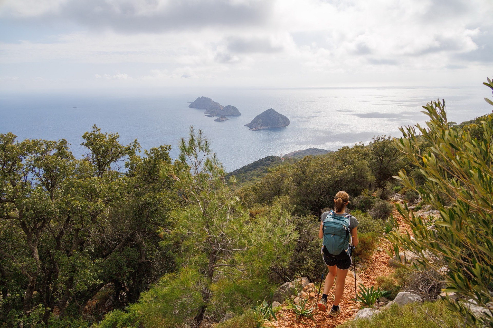
Almost nobody walks the Lycian Way in one go. Most walkers pick a sector, spend a week or a little more on it, and come back another year for the next one. This guide explains how we divide the trail on the ground, which stages we walk with our groups, and what to look at before you settle on your days.
How many days do you need for the Lycian Way?
For the full route, the Culture Routes Society, which created the trail and still maintains it, gives 760 km and roughly 35 days of walking, from Ovacık, above Ölüdeniz near Fethiye, to Geyikbayırı in the hills behind Antalya. Kate Clow researched and waymarked the route in 1999; it was Turkey’s first long-distance footpath. You will see other figures depending on the guidebook or website. We use the Society’s figure, since the Society looks after the waymarking and publishes route updates.
Few travellers have five weeks. So the real question becomes: which section, and how many days on it? Our programmes run from seven self-guided days, arrival and departure included, to thirteen guided days between Antalya and Kekova. On a one-week trip, count on four or five days actually on foot. On thirteen days, about ten.
Keep one thing in mind from the start: a week “on the Lycian Way” is not a continuous traverse. Our trips often link two distant sectors by road transfer, sometimes by boat. That is deliberate. The Lycian coast is long, and some stretches between two fine sections are dull tracks or tarmac. We would rather skip them.
How we divide the trail into three sectors
We think in terms of three broad sectors, each with its own character.
The west, around Fethiye. Ölüdeniz, Faralya above Butterfly Valley, Kabak, then the climb to Alınca and the ridge villages as far as Gey. This is the official start of the trail and the busiest sector. Village guesthouses are plentiful, which makes it the best ground for walking without a guide. The relief is serious: the balcony path hangs several hundred metres above the sea, and you pay for the view in climbs and descents. Patara, with its long beach and ancient city, closes the sector.
The east, between Antalya and Olympos. Here the mountains take over. The Beydağları range, pine and cedar forest, Mount Tahtalı (2,365 m), ancient Olympos beside its river, the flames of the Chimaera above Çıralı. Climbs are longer than in the west and the feel is more wooded. This is the sector we suggest to walkers who enjoy full days and proper passes.
The centre, around Kekova. Limestone hills, maquis, islets and the most indented coastline in Lycia. Simena beneath its castle, Üçağız on the site of ancient Teimiussa, Aperlai alone at the end of its peninsula. Height gains are modest, but the ground is often rocky and in full sun. Boats are part of the landscape here: several days end with a sail over the sunken city.
Each sector offers sea, mountains and ancient sites, just not in the same proportions. Only have a week? See The Lycian Way in one week: which section should you walk?
Our three Lycian programmes, stage by stage
The table below lists the stages and figures published in our programmes. Times are indicative walking times, breaks not included, for a group at an average pace. The self-guided programme does not show times or height gain in its overview; the route book you receive on arrival gives them in detail.
| Programme | Day | Stage | Walking | Ascent / descent |
|---|---|---|---|---|
| Antalya–Kekova (13 days) | 2 | Gedeller – Onobara – Sarısu beach | 4–5 h | +300 / −515 m |
| Antalya–Kekova | 3 | Fishing harbour – Beldibi – Göynük | 4–5 h | +450 / −450 m |
| Antalya–Kekova | 4 | Göynük canyon – Göynük hamlet, transfer to Yaylakuzdere | 5–6 h | +1,110 / −475 m |
| Antalya–Kekova | 5 | Yaylakuzdere – Mount Olympos pass – Beycik | 5–6 h | +925 / −980 m |
| Antalya–Kekova | 6 | Ulupınar – Maden bay – Çıralı | 5–6 h | +300 / −760 m |
| Antalya–Kekova | 8 | Olympos – Mount Musa – Adrasan | 6–7 h | +730 / −730 m |
| Antalya–Kekova | 9 | Adrasan – Gelidonya lighthouse – Pirates’ Bay | 6–7 h | +700 / −830 m |
| Antalya–Kekova | 10 | Kapaklı – Simena – Üçağız | 4–5 h | +100 / −175 m |
| Antalya–Kekova | 11 | Kılıçlı – Aperlai – Sıcak bay, return by boat | 4–5 h | +20 / −300 m |
| Chimaera, Kekova and Termessos (8 days) | 2 | Chimaera – Maden bay, return by boat (11.1 km) | 4–5 h | +350 / −570 m |
| Chimaera, Kekova and Termessos | 3 | Andriake – Simena (14.7 km) | 4–5 h | +200 / −200 m |
| Chimaera, Kekova and Termessos | 4 | Kılınçlı – Aperlai (6.1 km) | 3–4 h | +90 / −360 m |
| Chimaera, Kekova and Termessos | 5 | Alınca – Faralya (8.7 km) | 4–5 h | +170 / −720 m |
| Chimaera, Kekova and Termessos | 6 | Kirme – Faralya (8.7 km) | 4–5 h | +400 / −700 m |
| Chimaera, Kekova and Termessos | 7 | Kozağaç – Ölüdeniz (5.2 km), then a visit to Termessos (2.8 km) | 2–3 h, then 1.5–2 h | +40 / −480 m, then +194 / −187 m |
| Lycian Way self-guided (7 days) | 2–6 | Ölüdeniz – Faralya, Faralya – Kabak, Kabak – Alınca, Alınca – Gey, a day at Patara | in the route book | in the route book |
The Lycian Way from Antalya to Kekova is our most complete programme: thirteen days, level 3/5, from ancient Onobara to Limyra. Chimaera, Kekova and Termessos fits into eight days and hops from one sector to another, from Çıralı to Ölüdeniz, before the mountain city of Termessos. The self-guided Lycian Way stays in the west, seven days from Fethiye to Patara. For those who also want inland Turkey, Cappadocia and the Lycian Coast spends its second half around Ulupınar, Çıralı and Kekova.
Göynük to Yaylakuzdere: the climb everyone underestimates
Day 4 of our Antalya–Kekova programme sums up the trap of the Lycian Way. You leave the seafront, walk up the Göynük canyon between rock walls and running water, then follow the valley up to the hamlet of Göynük. On paper, 5 to 6 hours of walking. In your legs, 1,110 m of ascent. That is more than many Alpine stages.
The next day follows straight on. From Yaylakuzdere the path follows old transhumance routes through pine, cedar and juniper, crosses the pass facing Tahtalı and drops down to Beycik. Up 925 m, down 980 m. These two days follow each other with no easier day in between: that is the sequence to have already walked at home before you book.
We often tell our groups that a sea view says nothing about effort. A Lycian coastal path can climb several hundred metres to get round a cliff, then lose it all again down to a cove. The west is no exception. The climb from Kabak to Alınca is the big stage of the self-guided programme, and going the other way, the descent from Alınca to Faralya drops 720 m in 8.7 km.
To judge if these days suit you, take your biggest walk of the year and ask yourself if you could do it again the next morning. Our guide to assessing trek difficulty offers a more detailed method.
Descents, stones and heat: what really makes it hard
The Culture Routes Society describes the trail as a mix of Roman roads, old footpaths and mule tracks, often hard and stony underfoot. That is exactly what you walk on. Lycian limestone rolls, turns slippery where it has been polished, and tires the ankles far more than an earth path.
Descents count as much as climbs. Look at day 6 of the Chimaera, Kekova and Termessos trip: Kirme to Faralya, 400 m up but 700 m down. Or the end of Kozağaç–Ölüdeniz, 480 m down in 5.2 km to the lagoon. Weak knees feel it straight away. Poles help, provided you know how to use them on rock.
Distance alone does not tell the story either. Andriake–Simena is graded difficult with only 200 m of ascent: it is the longest stage of the week, 14.7 km over limestone where progress is slow and shade scarce. By contrast, Kılınçlı–Aperlai is short, 6.1 km, and runs downhill nearly all the way.
Then there is the heat. On the coast the sun is strong even in spring, and pale rock throws the light back at you. Our guides start early on exposed stages and put the lunch stop under a carob or a pine wherever the ground allows. Self-guided, that choice is yours: on the stretch from Kabak to Gey, setting off at eight changes the whole day.
Self-guided or guided on the Lycian Way?
We offer both, and they suit different travellers.
Self-guided. The self-guided Lycian Way runs for 2 to 15 people, without a guide. We book village guesthouses stage by stage, move your luggage every day, and hand over a route book and GPS tracks. Accommodation is on a bed-and-breakfast, half-board or full-board basis depending on the option chosen. Entrance fees to archaeological sites and museums are not included, nor is the airport transfer on the last day. You set your own pace, breaks and swims. You also handle navigation: waymarks can vanish on a regraded track, and finding the line again is up to you.
Guided. Our guided trips take 4 to 15 people, with a Turkish hiking guide who speaks the group’s language. Full board is included, picnic lunch and dinner, except meals on the first and last days. Programme transfers, luggage transfers and entrance fees for the listed sites are included. The guide chooses the start time, adjusts the stage if the heat builds or the sea rules out the boat, and tells the story of Olympos, Aperlai or Limyra along the way.
Our view from the field: the west lends itself to self-guided walking, because villages are close together and guesthouses are used to walkers. The east, with its passes and transfers, is better guided. Kekova, with its boats and isolated sites, needs the kind of organisation a local team handles without friction. We wrote a fuller comparison of regions and trek formats in Turkey.
Water, guesthouses and boats: the logistics of a Lycian day
Water. There are springs and cisterns along the trail, but you do not build a day around them. Some dry up at the end of summer, others are used by flocks. We always set off with water for the whole day. Carry plenty, more if the day is long and exposed; your guide or route book notes the known refill points in your sector. In villages a grocery or café often helps out, with no guarantee of opening hours.
Nights. According to the Culture Routes Society, there is somewhere to sleep every evening, in a village house, guesthouse or small hotel, except on three high sections. Our programmes use guesthouses and hotels: Göynük, Yaylakuzdere, Ulupınar, Çıralı, Adrasan and Üçağız on the Antalya–Kekova trip. Lycian guesthouses are simple and family-run. Dinner is often on the terrace, and home cooking easily matches a restaurant.
Luggage. It travels by vehicle from one night’s stop to the next on all our formats. You walk with a daypack: water, picnic, a warm layer, sun protection, swimwear. Our article on trekking gear for Turkey covers what should stay on your back.
Boats. Several stages end at sea. On day 2 of Chimaera, Kekova and Termessos, you return from Maden bay to Çıralı by boat. On day 11 of Antalya–Kekova, you board in Sıcak bay to sail along the sunken city and stop at Tersane, a former Byzantine shipyard. These days are therefore not walking loops. If the wind raises the sea, the captain decides, and we bring you back by land instead.
Transfers. Most are short: a quick drive to Yaylakuzdere, a bus from Beycik to Ulupınar, an early start to Kapaklı or Kılıçlı. They let you string together the best sections without walking on the road.
What you see on the way: the sites that justify a section
You also choose a sector for what it shows you. In the east, Olympos is best seen early in the morning, when light filters through the trees above the theatre, baths and sarcophagi. The Chimaera, Yanartaş, is a late-day visit: the flames rising from the rock show up better at dusk, and the sanctuary of Hephaistos keeps the memory of the creature slain by Bellerophon. The Gelidonya lighthouse, built in 1936, looks out over the Beş Adalar islets.
Around Kekova, Aperlai lived on the purple-dye trade; its walls, Lycian tombs, cisterns and harbour remains are still there. Simena, today Kaleköy, sits below its medieval fortress. Limyra, capital of the dynast Pericles, closes our thirteen-day programme with its theatre and springs.
In the west, Patara brings together its long beach and its ancient city. And at the end of the short trip, Termessos, high in the Taurus, is explored on foot over 2.8 km of theatre, walls and tombs. For a closer look at the east, read our guide to walks around Ulupınar and Çıralı.
When to go, and how to plan your stages?
The Culture Routes Society recommends February to May and September to November; summer is too hot for walking on the coast. Our programmes give April to June and September to October as the best periods for the Lycian trips, and up to November for Antalya–Kekova and for Cappadocia and the Lycian Coast. In spring the slopes are green and springs run better. In autumn the sea is still warm and invites a swim at the end of the stage. A storm is never ruled out, and a hot day can come in May as easily as in October. We cover seasons region by region in when to go hiking in Turkey.
To plan your stages, we always work in the same order:
- find the hardest day of the programme, up and down;
- look at the days before and after it, because it is the sequence that wears you out;
- confirm the overnight stop, any transfer and the option to cut the day short;
- carry water to the next known point, never relying on an uncertain spring;
- keep a quiet half-day in the week for a swim or a site.
If you are still torn between Lycia and another southern trail, our Lycian Way or St Paul Trail comparison sets them side by side. The Lycia page introduces the region, and our hiking trips in Turkey gather all our journeys.
Practical questions about bookings, insurance and formalities are collected in our FAQ.